Wednesday, July 4, 2012

The first recorded library in Ugarit in Syria

As far back as people could collect and organize information and documents, some form of a library has existed in history.

The first recorded library is believed to have been found in excavations at a site in Ugarit in Syria, which date back to around 1200 BC, where a palace library, temple library, and two private libraries containing diplomatic texts as well as poetry and other literary forms were unearthed.

In North America, personal collections of books brought over by French settlers in the 16th century are believed to be the first libraries in this hemisphere, and the oldest non-personal library on this continent was founded at The Jesuit College in Quebec City in 1635. Thomas Jefferson was known to have a glorious library at Monticello consisting of thousands of books, at a time when books were truly a rare commodity. He devised a classification system where he grouped his collection by subject rather than alphabetically, as libraries had previously done. Jefferson's collection became the nucleus of the first national collection of the United States at what is now known as the Library of Congress, after the congressional collection was destroyed by fire during the War of 1812.

Fast forward a few centuries. The U.S. Library of Congress has grown, as has the country. Public libraries, as we've come to know them, have long been more than just beautiful repository of books and other written materials, and are currently undergoing a new revolution as the Internet and electronic reading materials threaten their very existence. Fiscally, municipalities are financially pressed to maintain libraries as property taxes plummet and revenues follow, and some residents question why they need to bother going there if they have a computer to Google information, and an e-reader to download any book they want.

Librarians and library directors will tell you public libraries are much more than a place to find the latest best seller (although they definitely have those) or places only for people without computers, although they are a great provider of that service, as well. Public libraries have re-imagined their purpose, both expanding their services to offer more to a wider range of constituents, and have regrouped to be the community meeting place, offering classes and opportunities for assemblies of all ages and needs.

As one librarian in Oakland County sees it, "We have repositioned ourselves as a community meeting place and a source of community information. We offer so many programs that people cannot get anywhere else. We're like the kitchen of the house—everyone decorates their living rooms and bedrooms, but the kitchen is the heart of the house, and I think the library is the heart of the community."

Wednesday, May 9, 2012

Barada

The Barada is the main river of Damascus, the capital city of Syria. It flows through the spring of ‘Ayn Fījah (عين فيجة), about 27 km north west of Damascus in the Eastern Lebanon Mountains, but its source is Lake Barada, located at about 8 km from Zabadani. The Barada descends through a steep, narrow gorge named "Rabwe" before it arrives at Damascus, where it divides into seven branches that irrigate the oasis of Ghouta (الغوطة). The 'Barada' name is thought to derive from 'barid', i.e. 'cold'. The ancient Greek name means 'golden stream'.

Throughout the arid plateau region east of Damascus, oases, streams, and a few interior rivers that empty into swamps and small lakes provide water for local irrigation. Most important of these is the Barada, a river that rises in the Anti-Lebanon Mountains and disappears into the desert. The Barada creates the Al Ghutah Oasis, site of Damascus. This verdant area, some 370 square kilometers, has enabled Damascus to prosper since ancient times. From the mid-1980s onwards, the size of Al Ghutah was gradually being eroded as suburban housing and light industry from Damascus encroached on the oasis.

The river has suffered from severe drought in the last decades, mainly due to the lower rainfall rates and the large increase in the population in the region. It also suffers from serious pollution problems, especially in the summer, where there is almost no flow and little water in the basin.

Biblical mention

Barada is identified as Abana (or Amanah, classical Chrysorrhoas) which is the more important of the two rivers of Damascus, Syria and was mentioned in the Book of Kings (2 Kings 5:12). As the Barada rises in the Eastern Lebanon, and escapes from the mountains through a narrow gorge, its waters spread out fan-like, in canals or rivers, the name of one of which, the Banias river, retains a trace of Abana.

John MacGregor, who gives a description of them in his book Rob Roy on the Jordan, affirmed that as a work of hydraulic engineering, the system and construction of the canals, by which the Abana and Pharpar were used for irrigation, might be considered as one of the most complete and extensive in the world. In the Bible, Naaman exclaims that the Abana and Pharpar are greater than all the waters of Palestine.
 

Thursday, April 5, 2012

Damascus - the Ancient Town

(mosaic in the Umayyad Mosque)

Damascus is located some twenty miles east of the Anti-Lebanon mountains which mark the border between Syria and Lebanon; this range with peaks of over 10,000 ft. intercepts precipitations from the Mediterranean Sea so that the region of Damascus is subject to periods of drought (this seems to occur more frequently today than it did in the past); however this negative aspect is in part mitigated by streams which originate from the snow which accumulates in winter on the highest mountains.


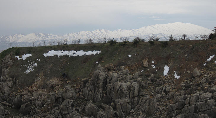
Mount Hermon
Mount Hermon in southern Anti-Lebanon seen from Zabadani in early March 2011

Damascus was founded on the southern bank of the Barada River and it was surrounded by Ghouta, an oasis where many vegetables, cereals fruits were farmed since the most ancient times; maps of Roman Syria indicate that the Barada emptied into a lake of some size east of Damascus; today it is called Bahira Atayba, the hesitant lake, because in years of severe drought it does not even materialize.
There are references to Damascus in the Bible and in Egyptian and Assyrian inscriptions, but the town was entirely redesigned by the Romans after Pompey conquered the region in 64-63 BC.

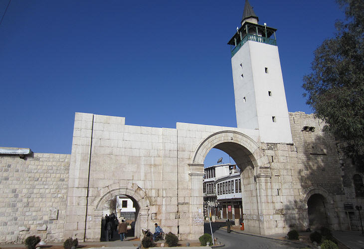
Bab Sharqi
Bab Sharqui (Eastern Gate)

The Old Town of Damascus has retained the almost rectangular shape of the Roman one with the Decumanus (east-west axis) twice as long as the Cardo (north-south axis). A monumental gate was built at the eastern end of Decumanus Maximus; the design of the gate is similar to Hadrian's Gate at Antalya and to Domitian's Gate at Hierapolis; all were built at a time when defence was not a key issue; the central opening was reserved for carriages while the side openings were utilized by pedestrians.

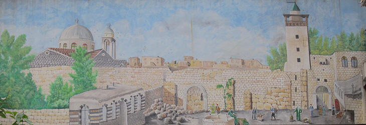
Bab Sharqi
Bab Sharqui in a modern painting based on an old photograph

When security conditions worsened the central and the left openings were closed and until the beginning of the XXth century the gate was limited to the opening near the minaret.

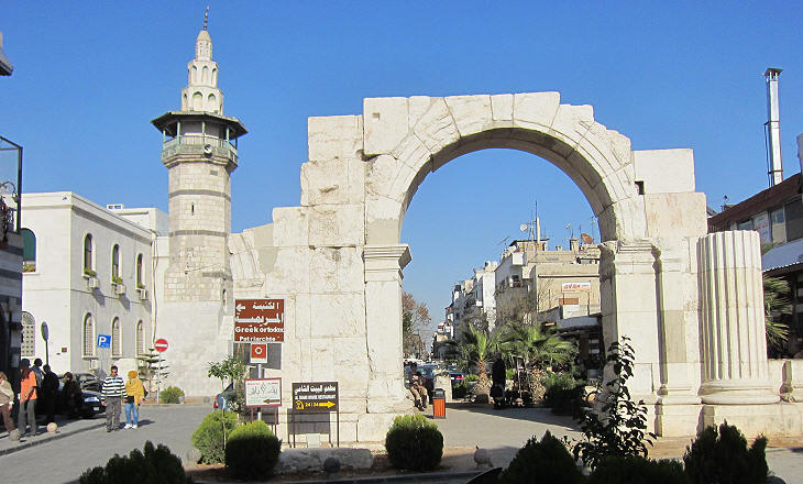
Roman Arch
Roman Arch across Via Recta

Decumanus Maximus, the main east-west street of Damascus, was a colonnaded street similar to those of Apamea and Palmyra; today it is known as Via Recta (Straight Street); its intersection with Cardo Maximus, the main north-south street was marked by an arch; today the structure of the Roman town is very evident; it was less so in 1867 when Mark Twain visited Damascus: The street called Straight is straighter than a corkscrew, but not as straight as a rainbow. St. Luke is careful not to commit himself; he does not say it is the street which is straight, but "the street which is called Straight". It is a fine piece of irony; it is the only facetious remark in the Bible, I believe.
In the following years Ottoman authorities pulled down many small dwellings and Via Recta returned to be straight; during the French Mandate (1920-46) the arch was reconstructed.

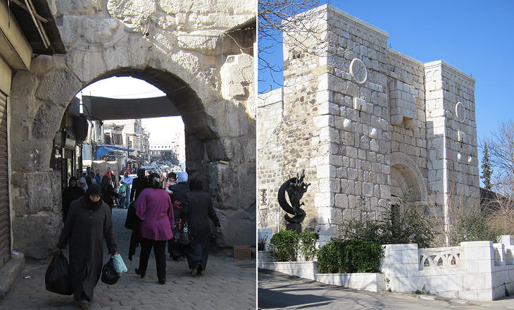
(left) Bab-as-Saghir (Narrow Gate); (right) Bab Kissan
(left) Bab as-Saghir (Narrow Gate); (right) Bab Kissan

Many of the other Roman gates of Damascus were modified or rebuilt by the Ayyubids and the Mamelukes (see page three), but Bab as-Saghir most likely retains the original Roman opening.
Today Bab Kissan is part of a modern Franciscan monastery; it is the reconstruction of a Mameluke gate built on the site of the Roman one; it houses a chapel and it is decorated with Christian symbols because St. Paul fled Damascus from this gate when the Jews who lived in the nearby quarter threatened to kill him for his heretical teachings.

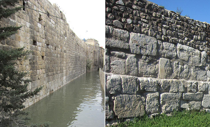
(left) Walls along the Barada River; (right) section of the southern walls showing the ancient stones
(left) Walls along the Barada River; (right) section of the ancient Roman walls near Bab Kissan

The fortifications of Roman Damascus do not appear particularly impressive; the Barada River gave some additional protection to the northern side of the town, but the lack of other natural barriers was not compensated by high walls and towers, although one must realize that the ground level at that time was most likely some ten ft. lower than it is today.
The Ayyubids and the Mamelukes did not strengthen the ancient walls in a significant manner, but built a citadel in the north-western corner of the town.

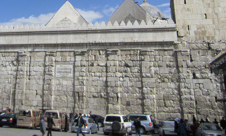
External wall of the Umayyad Mosque
External wall of the Temple to Jupiter which was incorporated into the Umayyad Mosque

The Romans believed that each site (mountain, river, wood, etc.) had its own deities (genius loci); this approach led them to accept the beliefs of the countries they conquered; in the case of Damascus the main temple was dedicated to Hadad, a Semitic god; for the Romans Hadad became Jupiter Damascenus (of Damascus); they did the same with Ba'al at Baetocece, a sanctuary north of Damascus.

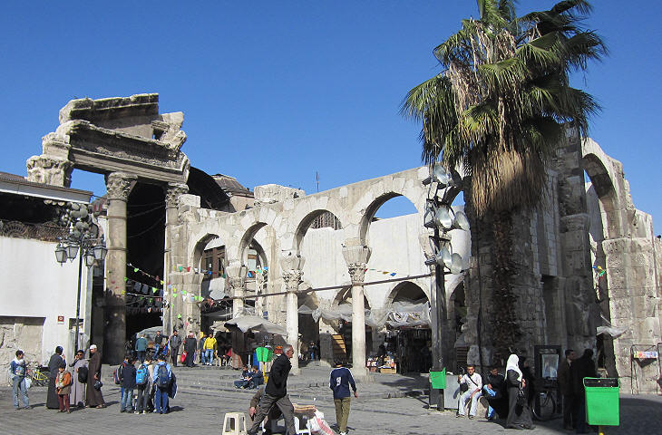
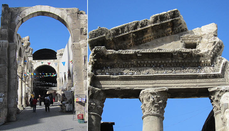
Eastern propylaeum of the Temple
Eastern Propylaeum of the Temple

The importance of religion in the Greek-Roman world was not very significant; it is difficult to remember the name of a high priest in Greek or Roman history; at most the names of a clairvoyant such as Tiresias or an augur (a priest who interpreted the will of the gods) such as Calchas come to mind. Religion played a much greater role in Egypt and in the Near East; this may explain the size of the Temple to Jupiter in Damascus, which is enormous when compared to that of the whole town. It was preceded by two propylaea (entrances) which led to the peribolos, a high wall which surrounded the temenos, the sacred space where the actual temple was located.

Western Propylaeum
Western Propylaeum

The construction of the Temple to Jupiter which replaced a previous sanctuary was started at the time of Emperor Augustus, but it was completed only during the reign of Emperor Septimius Severus. It is evident that the temple was an important sanctuary which attracted believers from the whole Near East.

Details
Western Propylaeum: details

Most likely the temple priests held an important role in the society of Damascus; they could rely on significant donations from the wealthiest citizens; from inscriptions celebrating additions/modifications to the temple it appears that they adopted Greek and Latin names, although ceremonies followed local practices.

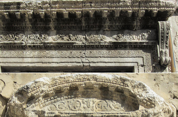
(above) Lintel of the southern entrance; (below) detail of a window
Temple to Jupiter: (above) lintel of the southern entrance to the temple with an inscription stating that it had been turned into a church; (below) detail of a window

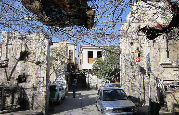
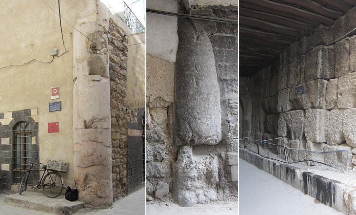
Eighteenth century travellers gave the first accounts of the Roman elements which were incorporated into the Umayyad Mosque which was built in the VIIIth century inside the peribolos. They spotted ancient columns between the houses which surrounded the mosque; some of them have since disappeared, but others can still be seen by walking in the neighbourhood north of the mosque.

Ancient columns
Ancient columns and walls in the neighbourhood near the Umayyad Mosque